The next generation navigational products and services to ensure safer, more harmonised and eco-efficient navigation in the Baltic Sea
The Finnish Transport and Communications Agency Traficom is a partner in the Baltic Sea e-Nav 'Shared waters – Same standards. Baltic Sea Partnership for Future Navigation' project, initiated in November 2023 and will run through October 2026.
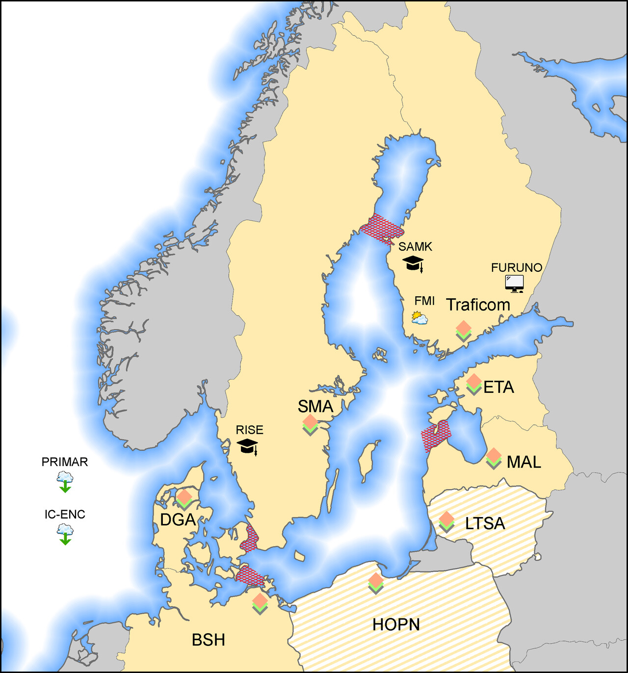
The project consortium consists of 10 partners including Traficom (Finland), Swedish Maritime Administration (Sweden, Lead Partner), Federal Maritime and Hydrographic Agency (Germany), Danish Geodata Agency (Denmark), Republic of Estonia Transport Administration (Estonia), Maritime Administration of Latvia (Latvia), Finnish Meteorological Institute (Finland), Satakunta University of Applied Sciences (Finland), RISE Research Institutes of Sweden AB (Sweden) ja Furuno Finland (Finland). Associated partners are Lithuanian Transport Safety Administration (Lithuania), Hydrographic Office of the Polish Navy (Poland), IC-ENC ja PRIMAR (Norway).
The Baltic Sea e-Nav project aims to develop the next generation of navigational products and services that comply with new international standards, enabling national authorities and maritime organizations to ensure safer, more efficient, and environmentally friendly navigation in the Baltic Sea. As we transition from today's navigation products to the new S-100 standards, it will be possible to design more energy-efficient routes, optimize the transport efficiency of vessels, and take into account particularly sensitive areas in operational planning. By introducing advanced digital navigation tools, ships will gain access to more detailed information on maritime weather and ocean conditions, improving voyage planning and overall navigation.
The project addresses the growing impact of digitalization on ship navigation, particularly the transition to S-100 navigational products, i.e., S-101 (Electronic Navigational Charts), S-102 (Bathymetry), S-104 (Water levels) and S-111 (Surface Currents) products. These innovations will enable the design of energy-efficient routes, reduce safety risks, and consider environmentally sensitive areas during operations.
| PROJECT OBJECTIVES | PERIOD |
| Develop production capabilities for, S-101 Electronic Navigational Charts (ENC), S-102 Bathymetry, S-104 Water levels (Finland), and S-111 Surface Currents (Finland) | 2023-2025 |
Establish harmonization rules for S-101, S-102, S-104 and S-111 products.
The harmonization rules will be adopted at the meeting of the Baltic Sea Hydrographic Commission (BSHC), where the Commission's Baltic Sea International Chart Coordination Working Group will prepare the matter for decision. | 2024-2026 |
| Test, evaluate and, refine the S-101, S-102, S-104 and S-111 products. | 2025 |
Begin the commercial rollout for S-101 and S-102 in the Baltic Sea. The commercial rollout for S-104 and S-111 products will take place partially in the Baltic Sea, but comprehensively for Finnish sea area. | 2026 |

The project is funded by the EU Interreg Baltic Sea Region Programme 2021-2027, and the total budget of the project is 4 883 540 euro. Implementation time is 01.11.2023 - 31.10.2026.
Enquiries:
Mirka Laurila-Pant, Special Adviser, mirka.laurila-pant@traficom.fi
Rainer Mustaniemi, Chief Advisor, rainer.mustaniemi@traficom.fi
